
Schooldays
Did you go to school in Walthamstow? Want to see pictures?
Pictures and stories here!
Here is a list of Street Names that no longer exist in Walthamstow.
It can be very useful if you are searching for streets mentioned in early census records.
The original list appeared in "The Streets of Waltham Forest - Volume One - Walthamstow", by A.D. Law, A.M.A. - Published in 1974 (Now out of print).
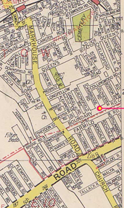
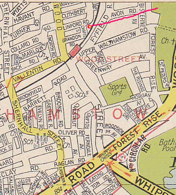
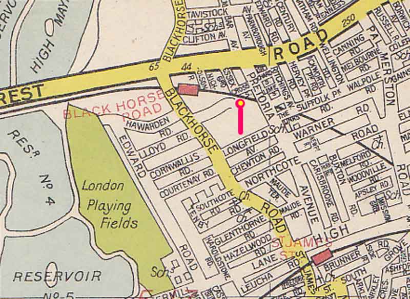
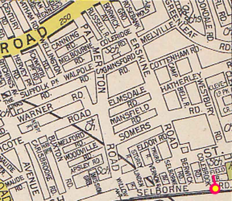
You may find interesting the links to map details of 'disappeared' roads...
Additions/Corrections are most welcome, for further changes have occurred since 1974. Contact Daniel [email]
For information on the Postal Zones go Here
| Street Name | Pre-1822 | Pref. | Plan. | Occup. | Made up | Name changed | New name | Origin of Name & Notes |
|---|---|---|---|---|---|---|---|---|
| Abbots Yard | Cherry Close | |||||||
| Alfred Street | 1879 | 1882 | Comely Bank Road | Probably named after Alfred Wilson. Vicar of Walthamstow 1848-51. | ||||
| Ambrey Lane | Yes | An earlier name for Folly Lane. Used during the 16th and 17th centuries. Derived from O.E. ampre = dock or sorrel. | ||||||
| Avenue Road | 1859 | 1886 | West Avenue | Named from the avenue of trees opposite Orford House. | ||||
| Back Lane | Yes | 1869 | Prospect Field | "Back" as viewed from the main entrance to the church. | ||||
| Beech Hall Gardens | 1930 | 1931 | Beech Hall Crescent | |||||
| Billet Lane | Yes | 1921 | Billet Road | Named as the lane leading to the "Crooked Billet" inn." | ||||
| Blind Lane | Yes | 1864 | 1888 | Wadham Road | ||||
| Boundary Lane | 1869 | 1875 | Boundary Road | Laid out on the line of the Walthamstow/Leyton boundary. | ||||
| Byfield Road | 1899 | Jan 1940 | Campus Road | Named after a partner of Houghton (solicitors) who owned some estates in Walthamstow. | ||||
| Cambridge Road
|
1869 | 1967 | (ceased) | Formerly lay between Beaconsfield and Colchester Roads. Probably named from the university town. | ||||
| Cedar Park | 1884 | 1887 | Cedars Avenue | Named from the house and estate called "The Cedars" - house demolished in 1882/3. | ||||
| Chapel End Lane | Yes | 25 Feb 1887 | Chingford Road | Named from the village of Chapel End. The Chapel was a Chantry Chapel founded by Sir William Tyrwhit in 1441. It fell into decay soon after 1555 (chantries being suppressed in 1547). | ||||
| Chapel Street
|
1903 | 1969 | (ceased) | Obliterated by the building of Stocksfield Road 1969. Named from the Brandon Road (originally Navvies) Mission, founded 1883. | ||||
| Charter Avenue | 1929 | 1940 | Bridge End | Original name in commemoration of Walthamstow receiving its charter as a Borough in 1929. | ||||
| Chestnut Avenue | 1893 | 1959 | North / South | Divided into North and South by the building of Warwick Girls' School 1959. General name from the tree, probably influenced by the proximity of Chestnut Walk. | ||||
| Chestnut Walk | Yes | 1871 | 1907 | Lea Bridge Road | That part of the road between Grove Road and Whipps Cross. Named from the fact that it was lined with chestnut trees. | |||
| Chievely Road | 1931 | 1956 | Kimberly Road (part) | Renamed in 1956 as part of Kimberley Road, of which it forms the eastern arm. Name from an incident in the South African War. | ||||
| Chingford Road | Yes | 1881 | Higham Hill Road | An earlier name for Higham Hill Road, certainly being used in 1879-81. So called as being the road leading from west Walthamstow and Higham Hill to Chingford Hall via Folly Lane. | ||||
| Church Common Lane | Yes | 1860 - 26 Feb 1886 | Orford Road | Parts renamed North Road (1855-60), Orford Road (c.1860), and Stanhope Road (c. 1860-1886). Renamed in its entirety as Orford Road 26th February 1886. Original naming because of its being a cart-track across the Church Common. | ||||
| Church Path | Yes | Beaulah Path | An alternative name for Beulah Path in the earlier nineteenth century. | |||||
| Church Path | Yes | Vallentin Road | Another name for Vallentin Road 1871-9. | |||||
| Church Road | Yes | 1863 | 1874 | 25th March 1886 | St. Mary Road | That part of the road between West Avenue and Church Path. p.1863, o. 1874. Naming self-explanatory. | ||
| Clarence Road | 1872 | So far this road has not been identified. (Clarence Road o. 1889 still exists) | ||||||
| Clarkson Road | 1871 | 1909 | Marlowe Road | |||||
| Clay Street | Yes | June 1886 | Forest Road | Originally that part of Forest Road from the Standard to the Water House. After the 17th century It incorporated Prior Street - the section from Water House to Wood Street. Name changed to Forest Road in June 1886. Original naming was probably directional - the street leading to Clay Hill (the hill at the Falnerston). | ||||
| Coopersale Avenue | Pref. | 1947-1961 | General naming from Coopersale near Epping. | |||||
| Coopersale Close | Pref. | 1947-1961 | General naming from Coopersale near Epping. | |||||
| Cottingham Road | Yes | The Bridle Path | So named Irom a Warner family connection: Sir T.C.T. Warner's great-great-grandfather Edward (d. 1815) married Sarah, daughter of the Rev.T. Brooke, of Cottingham, Yorkshire, | |||||
| Courtenay Mews | 1893 | 1903 | Courtenay Place Mews | Named after the landowner (Sir) Thomas Courtenay Theydon Warner, 1857-1934. | ||||
| Cromer Road | 1895 | 1903 | Albion Road | General naming from the seaside resort. | ||||
| Cross Street
|
1893 | 1969 | (ceased) | m. 1893-4. Street obliterated by rebuilding schemes - residents gone by November 1969. Naming self-explanatory - a cross-link between the former Essex Grove and Pretoria Avenue. | ||||
| East Street | 1862 | 1879 | St. Stephen's Road | So named as opposed to West Street, the two forming a bifurcation at the end of Wingfield Road. | ||||
| Eleanor Road | 1882 | 1885 | Helena Road | General naming from royalty - possibly in error for Helena, or possibly named from Queen Eleanor, wife of Edward I, whose funeral route was marked by crosses erected at its resting places (e.g. Waltham Cross). She died in 1290. | ||||
| Essex Grove | 1867 | 1973 | Essex Close | Last residents left by November 1973. Naming self-explanatory. | ||||
| Essex Hall | Pref. | 1947-1965 | Named from Essex Hall which had stood on that site until 1933. | |||||
| Evesham Road | 1909 | 1915 | Evesham Avenue | General naming from the Vale of Evesham, Worcestershire. | ||||
| Fairlight Road | 1898 | 1903 | Parkstone Road | |||||
| Ferndale Grove | 1892 | 1897 | 1898 (1907) | Wolsey Road (Avenue) | General name. | |||
| Field Road
|
1878 | 1882 | 1971 | (High Street Car Park) | Obliterated in 1971 by the formation of the High Street Car Park. Naming may refer to the field acquired as a Recreation Ground. | |||
| Fishers Avenue | Pref. | 1947-1961 | ||||||
| Fishers Close | Pref. | 1947-1961 | (No houses). | |||||
| Foster Road | 1900 | 1903 | Forster Road | Named after Richard Foster (1822-1910) - local benefactor for the building and support of churches, schools, etc. | ||||
| Gladstone Road | 1892 | 1885 | 1907 | Lynmouth Road | General name from the statesman William Ewart Gladstone (1809-98). | |||
| Green Leaf Lane | Yes | c.1894 | Hoe Street | Renamed as part of Hoe Street 1887 (the section from High Street to the Bell Corner) Hoe Street North (at the request of the postal authorities) 1889. Name self-explanatory - there was also a field on the west side called Green Leaves. | ||||
| Grove Place | 1862 | 1886 | Buxton Road | |||||
| Hagger Lane | Yes | June 1886 | Forest Road | "(That part of Forest Road between Wood Street and the forest). Name derived from the earlier form Hangerstrete - from O.E. hangra = "a wood growing on a hill-slope". | ||||
| Hawkesley Road | 1884 | 1892 | 1911 | Southcote Road | (formerly Hawkesley Terrace) Name changed to Hawkesley Road 1892- | |||
| Hawkesley Terrace | 1884 | 1892 | 1911 | Southcote Road | "Name changed to Hawkesley Road 1892/3, renamed Southcote Road 1911." | |||
| High View Road. | Probably an earlier name for Queenswood Avenue. (Sole mention is on a Kelly's map of c.1904). | |||||||
| Highlield Avenue | 1936 | 1940 | Bishops Close | General naming. | ||||
| Hillyfield or Hilly Field | Yes | Earlier name for the footpath now represented by Hurst Road. So named from being on the steep northern slope of the hill. | ||||||
| Hoe Street North | Yes | 1894 | Hoe Street | Known as Green Leaf Lane until 1887, renamed as part ol Hoe Street,1887, Hoe Street North (by request of the postal authorities) 1889, and back as part of Hoe Street from c.1894. Refers to that part of the street between High Street and the Bell corner. | ||||
| Hoggs Corner | Yes | 1901-2 | College Place | |||||
| Ilton Road | 1884 | Jan 1940 | Callis Road | General naming, either from the Ilton in Somerset or the one in the North Riding of Yorkshire. | ||||
| James's Road | 1903 | Queen's Road | (The west end of Queen's Road between Lennox Road and Markhouse Road), o. 1856. Named changed to Queen's Road West c.1883 | |||||
| James's Road | 1867 | 1886 | Byron Road | Became St. James's Road from 1871, and name changed to Byron Road 1886. | ||||
| Kings Street | 1884 | 1907 | Grange Road | General naming from royalty. | ||||
| Langland Close | Pref. | 1948-1958 | General naming, probably from William Langland. author of Piers Plowman, c.1330 - c.1400. | |||||
| Leigh Road | 1898 | 1906 | Turner Road | General naming from Leigh-on-Sea in Essex. | ||||
| Lennox Avenue | Genghis Khan Close | |||||||
| Lower Road | 1871 | 1909 | Marlowe Road | (eastern arm of present Marlowe Road) o. 1871, m.1878, renamed as part of Marlowe Road 1909. General naming being at the lower end of Marlowe Road. | ||||
| Manby Road | 1890/1 | 1892 | 1909 | Tenby Road | (formerly Munster Terrace) o. 1890/1, m.1892, n.c.1894, renamed as part of Tenby Road in 1909 (the western arm of Tenby Road). General naming from Manby in Lincolnshire." | |||
| Markhouse Lane | Yes | c.1875 | Markhouse Road | Named after Mark House. (which stood on the site of nos. 214-252. Markhouse Road), demolished in 1898. | ||||
| Marsh Street | Yes | 22 Dec 1882 | High Street | Originally included St. James's Street - first clearly separated 1871. Directional naming - the street leading to the marshes. | ||||
| Merriam Avenue | c.1900 | c.1939 | (ceased) | (formerly linking Higham Station Avenue to Larkshall Road near Halex). Named from a family connection with the Directors of British Xylonite Ltd. | ||||
| Middle Road | 1867 | Higham Street | ||||||
| Millers Close | Pref. | 1947-1961 | (no houses) | |||||
| Millers End | Pref. | 1947-1961 | ||||||
| Millfield Avenue | 1947 | (southward extension). Preserves the old name of part of Higham Hill Common. | ||||||
| Mission Street | 1887 | 1893 | 1897 | Mission Grove | Named after the School for the Daughters of Missionaries. 1832-1882. which stood nearby in High Street (now part of J.Davis, Ltd.). | |||
| Munster Terrace | 1890/1 | 1892 | 1909 | Tenby Road | Name changed to Manby Road 1894, and then incorporated into Tenby Road (the western arm) 1909. General naming - either from the Irish province, or from the town in Germany. | |||
| Navestock Road | 1947-1961 | General naming from Navestock in Essex. | ||||||
| New Cairo Road, | 1897 | c.1900 | Cairo Road | (eastern part of Cairo Road from No.29 onwards, and round the bend to Church Hill) , absorbed into Cairo Road c.1900. General naming from the Egyptian capital. | ||||
| Norman Road | Pref. | 1947-1960 | ||||||
| North Circular Road | 1929 | 1930 | Walthamstow Avenue | Naming self-explanatory. | ||||
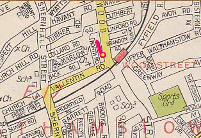
| North Road
|
1877 | 1970 | (ceased) | Modified latter part ol 1880. Last occupants moved out between October 1967 and October 1968 - tower block (Northwood Tower) occupied and road gone by October 1970. General naming, probably because the road ran northwards from Vallenlin Road to Marlowe Road. | ||||
| North Road | 1860 | Orford Road | Earlier name for part of Orford Road, probably the section Irom Third Avenue to the churchyard. General naming. | |||||
| Nursery Close
|
Pref. | 1947-1962 | So named because built on the site of an earlier nursery. (Maynard Infants' School now on the site). | |||||
| Parade, The | St. James's Street | Popular name for that part of St. James's Street between the station and High Street. In use some time after 1870. | ||||||
| Paramatta Road | 1900 | 1905 | Morland Road | General naming from Paramatta in New South Wales, Australia. | ||||
| Penn Road | Pref. | 1947-1960 | Named after William Penn of Pennsylvania (1644-1718). whose father had a house in Walthamstow. | |||||
| Pig Alley | Yes | 1891/2 | Beulah Path | |||||
| Prior Street - | Yes | Jun 1886 | Forest Road | That part of Forest Road from the Water House to Wood Street (although it is possible that the section in the vicinity of the College was known as Pynderstrete in 1519). Named from the Prior of Holy Trinity Priory at Aldgate in London, lord ol Ihe Rectory Manor (whose demesne lands lay on the south side from Shernhall Street to the Bell corner) from the 12th century until 1531. After the 17th century the name was dropped, and this part of the road was included in Clay Street. | ||||
| Prospect Field | 1877 | Prospect Hill | ||||||
| Providence Row | 1901/2 | College Place | ||||||
| Pynderstreet | Yes | Jun 1886 | Forest Road | Mentioned in 1519: probably that section of Forest Road in the vicinity of the College, later incorporated into Prior Street and - after the 17th century - as Clay Street. Named after the Pinder family of Walthamstow. | ||||
| Queen's Road East | 1878 | 1887 | 1903 | Queen's Road | Originally Queen's Road (part from Hoe Street to the Cemetery). Name changed to Queen's Road East c.1883. General naming from royalty - Queen Victoria. | |||
| Queen's Road West | 1856 | 1903 | Queen's Road | Formerly James Road, o. 1856, (part from Lennox Road to Markhouse Road). Name changed to Queen's Road West c.1883. General naming from royalty - Queen Victoria. | ||||
| St. James's Path | Yes | -1882 | 1972 | Cranbrook Mews | Named from proximity to St. James's church, founded 1842 and demolished 1962. | |||
| St. James's Road | 1867 | 1886 | Byron Road | Name used for James's Road from 1B71. | ||||
| Salisbury Hall Gardens | Chingford Road | Named from Salisbury Hall manor (the manor house standing a couple of hundred yards to the south), deriving ultimately from the family of Adam de Salesbury, who held the manor from 1322 until after 1400. | ||||||
| Salter's Buildings | Forest Rise | (alias Forest Rise) Name correctly applied to the buildings in the Lea Bridge Road section of Forest Rise 1725 - 1820 incorrectly applied to the buildings in the other section of Forest Rise c.1777 onwards. Name also applied to the roadway. Naming from Sir John Salter, who built the houses in 1725." | ||||||
| Selborne Road East | 1886 | 1886 | St. Mary Road | The earlier name for the western end of St. Mary Road (from Hoe Street to West Avenue), o. 1882. Name changed, with Church Road, to St. Mary Road 1886, m.1886. Sir Roundell Palmer (1812-1895) first Earl of Selborne or directly from Selborne in Hampshire. | ||||
| South Grove Road | 1859 | 1886 | Brunner Road | Lying to the south of the former Grove Place (Buxton Road). This would have been more obvious before the railway was built. | ||||
| Stafford Road | 1879 | Jan 1940 | St. Barnabas' Road | General naming from the peerage - the Barons Stafford. | ||||
| Stanford Road | Pref. | 1947-1961 | General naming from Stanford in Essex | |||||
| Stapleford Avenue | Pref. | 1947-1961 | General naming Irom Stapleford in Essex | |||||
| Stapleford Central | Pref. | 1947-1961 | General naming Irom Stapleford in Essex | |||||
| Stapleford Crescent | Pref. | 1947-1960 | General naming Irom Stapleford in Essex | |||||
| Stapleford End | Pref. | 1947-1961 | General naming Irom Stapleford in Essex | |||||
| Stapleford Path | Pref. | 1948-1961 | General naming Irom Stapleford in Essex | |||||
| Stapleford Road | Pref. | 1947-1961 | General naming Irom Stapleford in Essex | |||||
| Stoney Avenue | 1884 | 1891 | Stoneydown Avenue | Name derived from that of a house and estate which stood in the area bounded by Blackhorse Road, Forest Road, Pretoria Avenue, and Longfield Avenue. House demolished c.1936. Ultimately derived from Old English meaning "stoney hill." | ||||
| Telford Road | 1882 | 1892 | 1907 | Tenby Road | General naming - possibly from Thomas Telford (1757-1834), engineer. | |||
| Tregunter Road | 1958 | Handsworth Avenue | (no houses), shewn on maps of 1930-4 . (That part of the road between Falmoulh Avenue and Clivedon Road). General naming, either from Tregunter in Wales, or a west country surname. | |||||
| Troubridge Avenue | Pref. | 1947-1960 | Presumably named from H.M.S. Troubridge, the ship adopted by Walthamstow during the Second World War. | |||||
| Troubridge Road | Pref. | 1947-1961 | Presumably named from H.M.S. Troubridge, the ship adopted by Walthamstow during the Second World War. | |||||
| Vicarage Road | 1872 | 1875 | Church Hill Road | The road leading to the Vicarage from Shernhall Street. | ||||
| Victoria Road | 1887 | 1893 | Clacton Road | (near Gladstone - later Lynmouth - Road) General naming from royalty. For a period ol five years Walthamstow had two Victoria Roads, hence the qualifying note after the name. | ||||
| Warrens Avenue | Pref. | 1947-1961 | ||||||
| Warrens Road | Pref. | 1947-1960 | ||||||
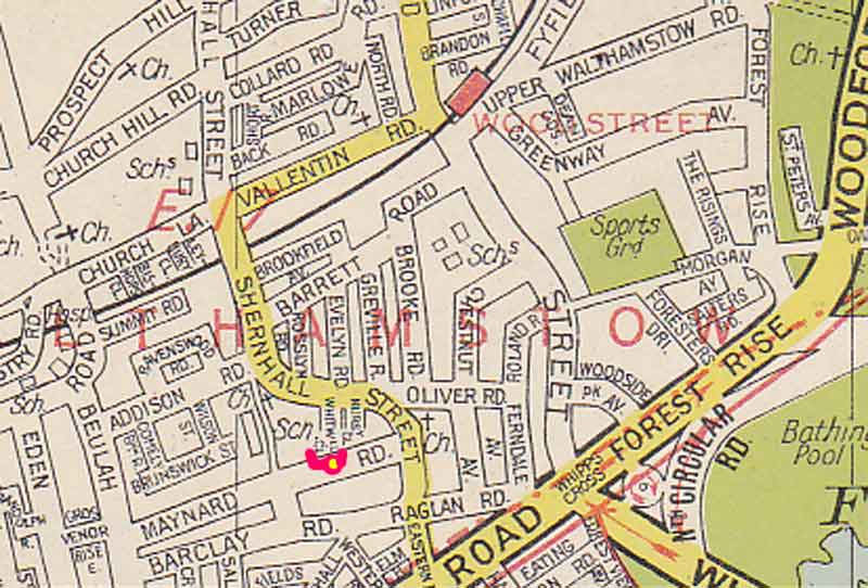
Warwick Road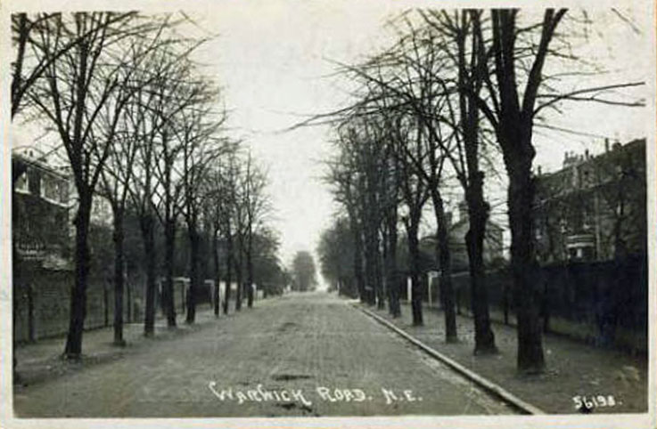
|
1898 | 1906 | Barrett Road | Named from the Earldom of Warwick: Lady Frances Evelyn Maynard, lady of the manor of Walthamstow Toni, married Lord Brooke In 1881. He succeeded to the title as 5th Earl ol Warwick in 1893. | ||||
| Werdestrete | Yes | Blackhorse Road/Lane? | Mentioned in 1277. Probably refers to Blackhorse Road and Lane. There was a "Werdeplake" in 1246, probably meaning "Hat enclosure" (weorth - enclosure plack flat) and called a park, which may have been the site of High Hall. Werdestrete means "street leading to the enclosure." | |||||
| West Avenue | 1882 | 1898 | West Avenue Road | |||||
| Whitewell Close
|
Pref. | 1948-1961 | In Shernhall Street - named from the field on which it was built (now the site of the Maynard Infants' School). | |||||
| Wilton Road | 1901/2 | Jan 1940 | Haldan Road | General naming from Wilton in Wiltshire. | ||||
| Wolsey Road | 1892 | 1897 | 1907 | Wolsey Avenue | (formerly Ferndale Grove) General naming from Thomas Wolsey (1475-1530), Cardinal and statesman. |
Walthamstow joined with Chingford and Leyton to form the London Borough of Waltham Forest in 1965 and left Essex. At that time part of Walthamstow
bulged into Chingford from Woodford, through Hale End and part of Highams Park.
As part of the merger, there were various boundary changes and this area became part of Chingford. (That’s why Walthamstow Stadium is now in
Chingford) Walthamstow gained a smaller area around Folly Lane.
The postal area system has a different base. Essentially, other than a couple of central London areas, the Post Office divided London into the 4 main compass points and then created a numbering system linked to the first letters of the alphabet of a district i.e.:
The same system applies to the N.S and W areas. Unfortunately, over the years the names of the districts are not so commonly used and there have been additions out of the sequence. In recent times the interesting addition has been the area around the Olympic Park, that has been designated as E20. Although generally, Walthamstow is E17 and Chingford is E4, there are some variations from this.
(Text kindly provided by Bill Bayliss)
Daniel J Quinn
Editor of Walthamstow Memories

Did you go to school in Walthamstow? Want to see pictures?
Pictures and stories here!
Have you lost trace of your family members who lived in Walthamstow? Leave a message and you might
get feedback from our visitors!
Or perhaps you can help someone in their search?
Are you seeking a friend you've lost touch with? Have a look at this page and you might find him/her? Or perhaps you can help someone in their search?
This site constantly grows thanks to the memories that you, our visitors, send in.
If you find that it's a pleasure reading, please consider writing too!